 Ranger Charlie Bray took a video with his drone of what is happening at Kent L. I thought it would be interesting to compare with aerials from the past from the Johnson County Property Information Viewer.
Ranger Bray’s Drone footage
Note — when this window opens you will have to hit play.
As the video comes on you be looking towards the Fishing Lot and the Beach. As the video progress, you will see the dump trucks crossing the path and proceeding N out of the lake to spoil sites. J
Around 14 minutes you will fly towards the dam and back up towards the fishing lot.
Historical Images
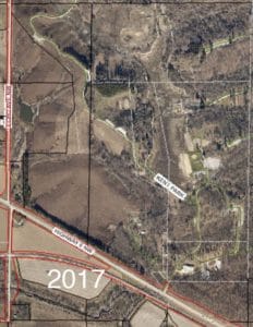
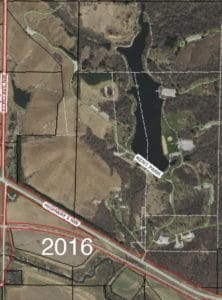
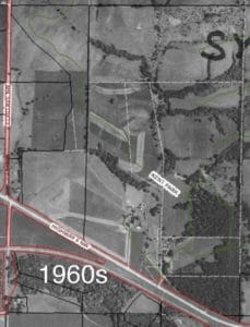
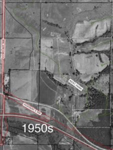
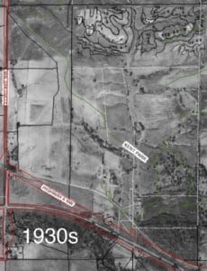 Unfortunately the photos available had contour lines drawn on them in places.