Tour of Cedar River Crossing & Ciha Fen Preserve on 6/9
by Rick Hollis
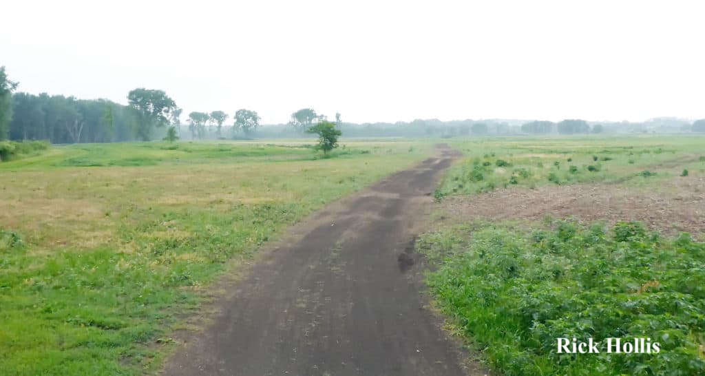
Looking S as we enter
Cedar River Crossing
When I arrived at CRC [Cedar River Crossing] early for the field trip, I had serious doubts we would get it off. It was raining; there was thunder and lightning, and there were dark clouds to the West. We had some pauses in the weather and my constant looking at the radar assured me that we should get the trip in, but as the people started to show up the sky got darker, and it rained harder.
But by the time we talked about the history and future of CRC and loaded up on the hay rack, the back of the pickup pulling the hay rack and the Mule, the rain was gone. The morning was rather pleasant. The afternoon at Ciha Fen was just as interesting but much hotter and more humid.
 Before I get into the events of the day let me start with a big tip of the hat to Connie Mutel [Iowa Native Plant Society], the people from Johnson County Conservation [Larry Gullett, Director], Dave Wehde, Mike Alexander and Blake Harris], John Alexander [senior consultant on the CRC Project from Applied Ecological Services], Aaron Basten [a retired biologist who visits Ciha Fen often] and Ben Rowald [another JCC volunteer who brought water to us from Iowa City.
Most of the photos from today were taken by two pretty talented guys, Larry Gullett [JCC] and Ken Heiar of La Porte City. Ken has a blog, http://speakingofnature.tumblr.com, and I invite you to look at more of his pictures there. A big thank you to Ken and Larry. Look at the pictures and click on them to enlarge each one.
The human history of this site is long and varied. There are four significant Native American sites [mound builder and pre mound builder]. In more recent times there was a spot where the Cedar River could be forded – this was used by Native Americans and pioneers up until the first bridges were built over the Cedar. Around 1840 when Mr Sutliff opened a ferry upriver at Sutliff. Changes in the river prevented Sutliff’s Ferry from operating and in 1898 the Sutliff Bridge was built. http://historicbridges.org/bridges/browser/?bridgebrowser=iowa/sutliffbridge/ There is also an 18thor early 19thcentury gypsy encampment.
When the original surveyors were walking sections lines in the 1840s, between Sections 10 and 11 in Cedar Township, they described a marvelous landscape. “That part of the Township lying northeast of the Red Cedar River is gently rolling, in some places broken, rather a sandy soil with a sparce growth of white and balck oak. On the river is a low bottom averaging about 30 chains on the east and north and about 60 chains on the south and west sides of the river, the southeast, central & northwest parts of the Township are broken and uneven with a small and scattering growth of burr, black, and red oak. The south west part is gently rolling, land of good quality and the only detriment to its speady settlement will be the want of timber.” As they walked on they found a variety of “low wet prairie, prairie, timber and river bottom w/ scattering timber.”
The plan that JCC has developed is to attempt to restore this region in prairie, various wet prairies and sloughs, which only connect to the Cedar when the river is high. A map & aerials of the region are below, along with the restoration plan for the N half of the property.
Everything is moving towards what it will be. The maps below give you an idea. Map A is a good general map, Map B shows what they are aiming for and Map C shows some of the things they will be doing to get there. I first saw CRC a year ago and there were parts in beans. It looks better already.
There are a number of really exciting parts of CRC, in the parts we explored: the sand prairie, oak – hawthorn savannah. Close to the river will be an open woodland with lagoons underfoot – somewhat like Swamp White Oak Preserve.
And we saw lots of things; Bastard Toadflax, Two-flowered Cynthia, Pale-Spiked Lobelia, Prairie Larkspur, Prairie Petunia, wild Four-O’clock, lots of Spiderworts, Hoary Puccoons. The area’s fauna side was also seen. Some of it indirectly — Larry showed us a Badger den, an E Hognosed Snake burrow. We heard tons of Dickcissels and heard Grasshopper Sparrows, Baltimore Orioles, and Warbling Vireos.
Photos from Cedar River Crossing
We had lunch at Baxa’s — according to Larry Gullett, “you cannot visit Ciha Fen without stopping at Baxa’s”.
Now on to Ciha Fen. Let’s start by saying in was damned hot and humid and no air was moving. Several of us wished we had stayed at Baxa’s. And let’s talk about some of the differences between CRC and CF, besides the Fen. They both have nice sand prairies and some of the same plants – but they are different. CRC is much moister while CF is drier and higher. The ~ 75′ elevation difference matters because CRC is about the same level as the Cedar R. The source of the sand is different. CRC’s sand is alluvial having been deposited as the Cedar floods and moves across the landscape. The sand at CF is wind blown [the fancy word here is aeolian]. That means the sand at CF in more uniform in size and finer grained.
We separated into a couple of groups here and wandered around looking at the landscape and fauna. The fen is about as dry as I have ever seen it. We saw a lot of different flowers.
As a general warning to those planning on visiting Ciha Fen soon, the Poison Ivy is tall and numerous.
All the rain we have had since our visit, probably makes CRC pretty impassible
Rick Hollis is the Founder of the Friends of Johnson County Conservation.
Rick Hollis